energy.wikisort.org - Power_plant
This is a list of electricity-generating power stations in the U.S. state of Pennsylvania, sorted by type and name. In 2019, Pennsylvania had a total summer capacity of 47,812 MW through all of its power plants, and a net generation of 228,995 GWh.[2] The corresponding electrical energy generation mix was 42.9% natural gas, 36.3% nuclear, 16.5% coal, 1.5% hydroelectric, 1.4% wind, 0.9% biomass, 0.4% non-biogenic waste, and 0.1% petroleum. Small-scale solar, which includes customer-owned photovoltaic panels, delivered an additional net 492 GWh of energy to the state's electrical grid. This was more than five times greater than the 83 GWh (0.04%) of generation by Pennsylvania's utility-scale photovoltaic plants.[1]
Sources of Pennsylvania utility-scale electricity generation:
full year 2021[1]
The generating mix in Pennsylvania has been shifting from coal to gas, as in other U.S. states. Extraction of the state's fossil-fuel resources for domestic and foreign export sale ranked among the highest in the nation during 2019.[3]
Nuclear power stations
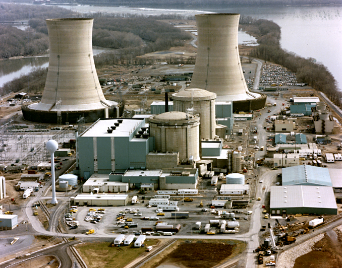
| Name | Location (County) | Coordinates | Capacity (MW) | Year Opened | Refs |
|---|---|---|---|---|---|
| Beaver Valley Nuclear Generating Station | Beaver | 40°37′23″N 80°25′50″W | 1,835 | 1976/1987 | |
| Limerick Generating Station | Montgomery | 40°13′35″N 75°35′14″W | 2,296 | 1986/1990 | |
| Peach Bottom Nuclear Generating Station | York | 39°45′30″N 76°16′5″W | 2,251 | 1974 | |
| Susquehanna Steam Electric Station | Luzerne | 41°05′19″N 76°08′56″W | 2,520 | 1983/1985 | |
Source: U.S. Energy Information Administration (MW Totals as of August 2014)
Fossil-fuel power stations
Data from the U.S. Energy Information Administration serves as a general reference.[4]
Coal
| Name | Location (County) | Coordinates | Capacity (MW) | Year Opened | Refs |
|---|---|---|---|---|---|
| Brunner Island Steam Electric Station | York | 40°05′44″N 76°41′49″W | 1,567 | 1969 | |
| Colver Power Project | Cambria | 40°33′00″N 78°48′00″W | 118 | 1995 | |
| Conemaugh Generating Station | Indiana | 40°23′05″N 79°03′49″W | 1,872 | 1970/1971 | |
| Ebensburg Power | Cambria | 40°27′18″N 78°44′50″W | 50 | 1990 | |
| Foster Wheeler Mt Carmel Cogen | Northumberland | 40°48′40″N 76°27′11″W | 43 | 1990 | |
| Homer City Generating Station | Indiana | 40°30′39″N 79°11′37″W | 2,022 | 1969/1977 | |
| John B Rich Power Station | Schuylkill | 40°47′25″N 76°11′54″W | 80 | 1988 | |
| Keystone Generating Station | Armstrong | 40°39′36″N 79°20′27″W | 1,872 | 1967/1968 | |
| Northampton Generating Company | Northampton | 40°41′30″N 75°28′45″W | 134 | 1995 | |
| Panther Creek | Carbon | 40°51′20″N 75°52′41″W | 83 | 1992 | |
| Scrubgrass Generating Plant | Venango | 41°16′09″N 79°48′48″W | 85 | 1993 | |
| Seward | Indiana | 40°24′22″N 79°02′01″W | 585 | 2004 | |
| Spring Grove Facility | York | 39°52′15″N 76°52′05″W | 36 | 1989 | |
| St Nicholas Cogen Plant | Schuylkill | 40°49′20″N 76°10′25″W | 86 | 1990 | |
| TalenEnergy Montour | Montour | 41°04′17″N 76°40′02″W | 1,758 | 1972/1973 | |
| Westwood Generation | Schuylkill | 40°37′09″N 76°27′00″W | 30 | 1987 | |
| Wheelabrator Frackville | Schuylkill | 40°48′06″N 76°10′30″W | 48 | 1988 |
Natural gas
| Name | Location (County) | Coordinates | Capacity (MW) | Generation Type | Year Opened | Refs |
|---|---|---|---|---|---|---|
| Allegheny Energy | Allegheny | 40°32′43″N 79°46′07″W | 556 | 2x1 Combined Cycle | 2003 | |
| Armstrong | Armstrong | 40°38′17″N 79°21′06″W | 688 | Simple Cycle (x4) | 2002 | |
| Bethlehem Power Plant | Northampton | 40°37′03″N 75°18′53″W | 1,153 | 3x1 Combined Cycle (x2) | 2002/2003 | |
| Birdsboro | Berks | 40°16′07″N 75°47′59″W | 525 | Combined Cycle | 2019 | |
| Brunner Island | York | 40°05′46″N 76°41′46″W | 768.3 | Steam Turbine (x2) | 1961/1965 | |
| Brunot Island | Allegheny | 40°27′54″N 80°02′38″W | 339.9 | 3x1 Combined Cycle | 1973/1974 | |
| Bucknell University | Union | 40°57′18″N 76°52′44″W | 5.9 | 1x1 Combined Cycle | 1991/1998 | |
| Chambersburg | Franklin | 39°52′01″N 77°41′09″W | 87.6 | Simple Cycle (x2) | 2001 | |
| Clairton Works[A] | Allegheny | 40°18′35″N 79°52′55″W | 31 | Steam Turbine (x2) | 1955 | |
| CPV Fairview Energy Center | Cambria | 40°24′43″N 78°51′18″W | 1,197 | 2x1 Combined Cycle | 2019 | |
| Eddystone Generating Station | Delaware | 39°51′29″N 75°19′23″W | 782 | Steam Turbine (x2) | 1974/1976 | |
| Erie Coke[A] | Erie | 42°08′38″N 80°04′11″W | 2.5 | Steam Turbine | 1953 | |
| Fairless Energy Center | Bucks | 40°08′51″N 74°44′28″W | 1,338 | 2x1 Combined Cycle (x2) | 2004 | |
| Fayette Energy Center | Fayette | 39°51′33″N 79°55′06″W | 644.1 | 2x1 Combined Cycle | 2003 | |
| Gans | Fayette | 39°44′51″N 79°50′20″W | 87.6 | Simple Cycle (x2) | 2000 | |
| Grays Ferry Cogeneration | Philadelphia | 39°56′32″N 75°11′17″W | 192.6 | Steam Turbine Simple Cycle | 1997 (57.6MW) 1997 (135MW) | |
| Handsome Lake Energy | Venango | 41°17′27″N 79°48′22″W | 294.5 | Simple Cycle (x5) | 2001 | |
| Hazelton | Luzerne | 40°55′42″N 76°02′27″W | 171.5 | Simple Cycle (x4) | 1989/2002 | |
| Hunlock Power Station | Luzerne | 41°12′02″N 76°04′12″W | 189.9 | 2x1 Combined Cycle Simple Cycle | 1959/2011 (145.9MW) 2000 (44MW) | |
| Hunterstown Power Plant | Adams | 39°52′21″N 77°10′02″W | 898 | 3x1 Combined Cycle | 2003 | |
| Ironwood | Lebanon | 40°21′03″N 76°21′57″W | 777.6 | 2x1 Combined Cycle | 2001 | |
| Lackawanna Energy Center | Lackawanna | 41°28′17″N 75°32′39″W | 1,665 | Combined Cycle (x3) | 2018 | |
| Liberty Electric Power Plant | Delaware | 39°51′41″N 75°20′09″W | 614 | 2x1 Combined Cycle | 2002 | |
| Lower Mount Bethel Energy | Northampton | 40°48′07″N 75°06′27″W | 651.6 | 2x1 Combined Cycle | 2004 | |
| Marcus Hook Energy | Delaware | 39°48′37″N 75°25′41″W | 836.1 | 3x1 Combined Cycle | 2004 | |
| Mon Valley Works[A] | Allegheny | 40°23′33″N 79°51′23″W | 52.5 | Steam Turbine (x3) | 1943/2002 | |
| Moxie Freedom Generation Plant | Luzerne | 41°06′47″N 76°09′29″W | 1,058 | Combined Cycle (x2) | 2018 | |
| New Castle | Lawrence | 40°56′16″N 80°22′08″W | 348 | Steam Turbine (x3) | 1952/1958/1964 | |
| Newman | Philadelphia | 40°00′50″N 75°03′10″W | 1.8 | Steam Turbine | 1964 | |
| Ontelaunee Energy Center | Berks | 40°25′19″N 75°56′08″W | 728 | 2x1 Combined Cycle | 2002 | |
| Panda Hummel Station | Snyder | 40°50′20″N 76°49′32″W | 1,194.4 | 3x1 Combined Cycle | 2018 | [5] |
| Panda Liberty Generation (Hamilton Liberty) | Bradford | 41°46′03″N 76°23′24″W | 870 | Combined Cycle (x2) | 2016 | |
| Panda Patriot Generation (Hamilton Patriot) | Lycoming | 41°10′51″N 76°50′21″W | 870 | Combined Cycle (x2) | 2016 | |
| Procter&Gamble Mehoopany Mill | Wyoming | 41°34′27″N 76°02′36″W | 117.6 | Simple Cycle (x2) | 1985/2013 | |
| Shawville | Clearfield | 40°04′03″N 78°21′58″W | 526 | Steam Turbine (x4) | 1954/1959/1960 | |
| Spring Grove Facility | York | 39°52′15″N 76°52′05″W | 18.6 | Steam Turbine (x3) | 2019 | |
| Springdale | Allegheny | 40°32′48″N 79°46′06″W | 87.6 | Simple Cycle (x2) | 1999 | |
| TalenEnergy Martins Creek | Northampton | 40°47′52″N 75°06′19″W | 1,794.4 | Simple Cycle (x4) Steam Turbine (x2) | 1971 (94.4MW) 1975/1977 (1700MW) | |
| Tenaska Westmoreland | Westmoreland | 40°10′31″N 79°41′48″W | 940 | 2x1 Combined Cycle | 2018 | [6] |
| West Campus Steam Plant | Centre | 40°47′34″N 77°51′53″W | 5.1 | Steam Turbine (x2) | 2017 | |
| York Energy Center | York | 39°44′15″N 76°18′24″W | 1,449.4 | 3x1 Combined Cycle 2x1 Combined Cycle | 2011 (560MW) 2019 (889.4MW) | |
| York Generation Company | York | 39°59′08″N 76°40′34″W | 52.2 | 2x1 Combined Cycle (x2) | 1989 | |
A The Clairton, Erie, and Mon Valley facilities burn other hydrocarbon gases released during processing of coal to produce coke.
Petroleum
This list is incomplete; you can help by adding missing items. (April 2021) |
| Name | Location (County) | Coordinates | Capacity (MW) | Generation Type | Year Opened | Refs |
|---|---|---|---|---|---|---|
| Croydon CT Generating Station | Bucks | 40°04′48″N 74°53′30″W | 546.4 | Simple Cycle (x8) | 1974 | |
| Portland | Northampton | 40°54′37″N 75°04′46″W | 194 | Simple Cycle (x3) | 1967/1971/1997 | |
Renewable power stations
Data from the U.S. Energy Information Administration serves as a general reference.[4]
Biomass and Municipal Waste
| Name | Location (County) | Coordinates | Capacity (MW) | Primary Fuel | Generation Type | Year Opened | Refs |
|---|---|---|---|---|---|---|---|
| Archbald Power Station | Lackawanna | 41°29′06″N 75°32′26″W | 32.4 | landfill gas | Steam Turbine Simple Cycle (x2) | 1988 (23.2MW) 2010 (9.2MW) | |
| Broad Mountain | Schuykill | 40°40′11″N 76°22′51″W | 11 | landfill gas | Simple Cycle (x2) | 2009 | |
| Covanta Delaware Valley | Delaware | 39°49′35″N 75°23′18″W | 90 | municipal solid waste (biogenic & non-biogenic) | Steam Turbine | 1991 | |
| Covanta Plymouth | Montgomery | 40°05′48″N 75°18′37″W | 32.1 | municipal solid waste (biogenic & non-biogenic) | Steam Turbine | 1991 | |
| Fairless Hills | Bucks | 40°08′26″N 74°45′02″W | 60 | landfill gas | Steam Turbine (x2) | 1996 | |
| Gettysburg Facility | Adams | 39°57′01″N 77°07′31″W | 3.3 | other biomass solids | Steam Turbine | 2013 | |
| Glades Pike Generation Plant | Somerset | 40°00′24″N 79°02′28″W | 6.5 | landfill gas | Reciprocating Engine (x2) Simple Cycle | 2011 (3.2MW) 2011 (3.3MW) | |
| Green Knight EC | Northampton | 40°51′33″N 75°15′46″W | 9.9 | landfill gas | Simple Cycle (x3) | 2001 | |
| Keystone Recovery | Lackawanna | 41°26′11″N 75°35′54″W | 5.6 | landfill gas | Reciprocating Engine (x7) | 1995/1996 | |
| Harrisburg Facility | Dauphin | 40°14′39″N 76°51′14″W | 24.1 | municipal solid waste (biogenic & non-biogenic) | Steam Turbine | 2006 | |
| Johnsonburg Mill | Elk | 41°29′29″N 78°40′33″W | 54 | wood/wood waste | Steam Turbine | 1993 | |
| Lancaster County | Lancaster County | 40°04′16″N 76°38′37″W | 35.7 | municipal solid waste (biogenic & non-biogenic) | Steam Turbine | 1990 | |
| Mountain View | Franklin | 39°48′05″N 77°47′18″W | 14.4 | landfill gas | Reciprocating Engine (x48) | 2003 | |
| Pennsbury | Bucks | 40°09′11″N 74°46′09″W | 6.0 | landfill gas | Simple Cycle (x2) | 1996 | |
| Pine Grove | Schuylkill | 40°33′19″N 76°23′19″W | 5.4 | landfill gas | Reciprocating Engine (x18) | 2008 | |
| Pioneer Crossing Energy | Berks | 40°16′30″N 75°49′00″W | 8.0 | landfill gas | Reciprocating Engine (x5) | 2008/2013 | |
| PWD Cogen Plant | Philadelphia | 39°59′19″N 75°05′00″W | 5.6 | other biomass gas | Reciprocating Engine (x4) | 2013 | |
| Spring Grove Facility | York | 39°52′15″N 76°52′05″W | 39.1 | wood/wood waste | Steam Turbine | 1994 | |
| Waste Management Arden | Washington | 40°12′21″N 80°15′40″W | 4.8 | landfill gas | Reciprocating Engine (x6) | 2009 | |
| Wheelabrator Falls | Bucks | 40°09′45″N 74°46′06″W | 53.3 | municipal solid waste (biogenic & non-biogenic) | Steam Turbine | 1994 | |
| York County | York | 40°00′06″N 76°43′06″W | 36.5 | municipal solid waste (biogenic & non-biogenic) | Steam Turbine | 1989 | |
Hydroelectric
| Name | Location (County) | Coordinates | Capacity (MW) | Number of Turbines | Year Opened | Refs |
|---|---|---|---|---|---|---|
| Allegheny Hydro Partners No. 5 | Armstrong | 40°40′58″N 79°39′55″W | 6.0 | 2 | 1988 | |
| Allegheny Hydro Partners No. 6 | Armstrong | 40°42′59″N 79°34′38″W | 8.0 | 2 | 1988 | |
| Allegheny Hydro Partners No. 8 | Armstrong | 40°53′48″N 79°28′44″W | 13.6 | 2 | 1990 | |
| Allegheny Hydro Partners No. 9 | Armstrong | 40°57′22″N 79°33′03″W | 17.8 | 2 | 1990 | |
| Beaver Valley- Patterson | Beaver | 40°37′19″N 80°26′01″W | 1.2 | 3 | 1982 | |
| Conemaugh Dam | Indiana & Westmoreland | 40°27′52″N 79°21′57″W | 14.0 | 2 | 1989 | |
| Holtwood Dam | Lancaster & York | 39°49′37″N 76°20′07″W | 109 | 14 | 1910-1914/1924/ 2011-2013 | |
| Lake Lynn Hydro | Fayette | 39°43′13″N 79°51′22″W | 51.2 | 4 | 1926/1929 | |
| Mahoning Creek | Armstrong | 40°55′16″N 79°16′54″W | 6.6 | 1 | 2013 | |
| Piney Hydroelectric | Clarion | 41°11′32″N 79°26′01″W | 27.0 | 3 | 1924/1928 | |
| Safe Harbor Dam | Lancaster & York | 39°55′14″N 76°23′33″W | 422.5 | 14 | 1931-1934/1940/ 1985-1986 | |
| Townsend Hydro | Beaver | 40°44′01″N 80°18′53″W | 4.2 | 2 | 1987 | |
| Wallenpaupack | Pike & Wayne | 41°28′04″N 75°07′51″W | 44.0 | 2 | 1926 | |
| Warrior Ridge Hydro | Huntingdon | 40°32′24″N 78°02′05″W | 2.8 | 4 | 1985 | |
| William F. Matson | Huntingdon | 40°26′01″N 78°00′24″W | 21.0 | 2 | 1988 | |
| York Haven Dam | Dauphin, Lancaster & York | 40°07′03″N 76°42′55″W | 20.0 | 1 | 1905 | |
| Yough Hydro Power | Fayette & Somerset | 39°48′06″N 79°22′06″W | 12.2 | 2 | 1989 |
Solar
This list is incomplete; you can help by adding missing items. (April 2021) |
| Name | Location (County) | Coordinates | Capacity (MWAC) | Year Opened | Refs |
|---|---|---|---|---|---|
| Keystone Solar | Lancaster | 39.8611°N 76.2211°W | 5.0 | 2012 | |
| PA Solar Park | Carbon | 40.8601°N 75.8522°W | 10.1 | 2012 | |
| White Tail Solar | Franklin | 40.1414°N 77.6097°W | 13.5 | 2019 | |
Wind
| Name | Location (County) | Coordinates | Capacity (MW) | Number of Turbines | Year Opened | Refs |
|---|---|---|---|---|---|---|
| Allegheny Ridge Wind Farm | Cambria | 40°23′02″N 78°34′46″W | 80.0 | 40 | 2007 | |
| Armenia Mountain Wind Farm | Bradford & Tioga | 41°45′43″N 76°51′19″W | 100.5 | 67 | 2009 | |
| Bear Creek Wind Power Project | Luzerne | 41°14′07″N 75°45′11″W | 24.0 | 12 | 2006 | |
| Big Level Wind | Potter | 41°52′09″N 77°39′57″W | 90.0 | 25 | 2019 | |
| Casselman Wind Power Project | Somerset | 39°51′00″N 79°08′17″W | 34.5 | 23 | 2007 | |
| Chestnut Flats Wind | Blair | 40°31′22″N 78°28′37″W | 38.0 | 19 | 2011 | |
| Forward Wind | Somerset | 40°05′07″N 78°51′48″W | 29.4 | 14 | 2008 | |
| Highland Wind (I&II) | Cambria | 40°18′15″N 78°41′27″W | 137.5 | 55 | 2009/2012 | |
| Laurel Hill Wind | Lycoming | 41°31′56″N 77°01′47″W | 69.0 | 30 | 2012 | |
| Locust Ridge Wind Farm (I&II) | Schuylkill | 40°51′18″N 76°07′45″W | 128.0 | 64 | 2007/2009 | |
| Lookout Wind | Somerset | 39°52′46″N 78°55′06″W | 37.8 | 18 | 2008 | |
| Mehoopany Wind Energy | Wyoming | 41°25′14″N 76°02′57″W | 140.8 | 88 | 2012 | |
| Meyersdale Wind Farm | Somerset | 39°47′27″N 79°00′07″W | 30.0 | 20 | 2003 | |
| Mill Run Wind Energy Center | Somerset | 39°54′48″N 79°23′37″W | 15.0 | 10 | 2001 | |
| North Allegheny Wind | Blair | 40°26′17″N 78°32′37″W | 70.0 | 35 | 2009 | |
| Patton Wind | Cambria | 40°37′51″N 78°41′46″W | 30.0 | 15 | 2012 | |
| PPL Frey Farm Landfill Wind | Lancaster | 39°57′33″N 76°27′20″W | 3.2 | 2 | 2011 | |
| Ringer Hill Wind | Somerset | 39°44′41″N 79°11′17″W | 39.9 | 14 | 2016 | |
| Sandy Ridge Wind Farm | Blair & Centre | 40°43′45″N 78°17′15″W | 48.2 | 35 | 2012 | |
| Somerset Wind Farm | Somerset | 39°58′45″N 79°00′46″W | 9.0 | 6 | 2001 | |
| South Chestnut Wind Project | Fayette | 39°45′05″N 79°43′38″W | 50.4 | 23 | 2012 | |
| Stoney Creek Wind | Somerset | 40°01′52″N 78°48′55″W | 52.5 | 35 | 2009 | |
| Twin Ridges Wind | Somerset | 39°45′38″N 78°52′29″W | 139.4 | 68 | 2012 | |
| Waymart Wind Farm | Wayne | 41°33′12″N 75°27′15″W | 64.5 | 43 | 2003 |
Storage power stations
Data from the U.S. Energy Information Administration serves as a general reference.[4]

Battery
| Name | Location (County) | Coordinates | Capacity (MW) | Year Opened | Refs |
|---|---|---|---|---|---|
| Green Mountain Storage | Somerset | 39°51′05″N 79°04′14″W | 10.4 | 2016 | [7] |
| Meyersdale Battery | Somerset | 39°47′27″N 79°00′08″W | 18.0 | 2015 | [8] |
Flywheel
| Name | Location (County) | Coordinates | Capacity (MW) | Number of Flywheels | Year Opened | Refs |
|---|---|---|---|---|---|---|
| Hazle Spindle | Luzerne | 40°56′58″N 76°02′51″W | 20.0 | 1 | 2013 |
Pumped Storage
| Name | Location (County) | Coordinates | Capacity (MW) | Number of Turbines | Year Opened | Refs |
|---|---|---|---|---|---|---|
| Muddy Run Pumped Storage Facility | Lancaster | 39°48′29″N 76°17′53″W | 1,071 | 8 | 1967/1968 | |
| Seneca Pumped Storage Generating Station | Warren | 41°50′21″N 79°00′13″W | 435 | 2 | 1970 | |
Former power stations
| Name | Type | Location (County) | Coordinates | Capacity (MW) | Decommissioned |
|---|---|---|---|---|---|
| Armstrong Power Plant | Natural Gas/Diesel | Armstrong | 40°55′45″N 79°27′59″W | 600 | 2012 |
| Chester Waterside Station[9] | Coal, natural gas | Delaware | 39°49′45″N 75°23′2″W | 1,242 | 1981 |
| Hatfield's Ferry Power Station | Coal | Greene | 39°51′20″N 79°55′39″W | 1,700 | 2013 |
| Mitchell Power Station | Coal, oil | Washington | 40°13′16″N 79°58′6″W | 370 | 2014 |
| Frank R. Phillips Power Station | Coal | Beaver | 40°34′8″N 80°13′43″W | 1990s | |
| George F. Weaton Power Station | Coal | Beaver | 40°40′2″N 80°20′46″W | 110 | 2012 |
| Bruce Mansfield Power Plant | Coal | Beaver | 40°38′06″N 80°24′55″W | 2,490 | 2019 |
| Cromby Generating Station[10] | Coal | Chester | 40°9′11″N 75°31′44″W | 118 | 2011 |
| Sunbury Generation Plant[11] | Coal | Snyder | 400 | 2014 | |
| Cheswick Generating Station | Coal | Allegheny | 40°32′18″N 79°47′29″W | 635 | 2022[12] |
| Three Mile Island Nuclear Generating Station | Nuclear | Dauphin | 40°09′14″N 76°43′29″W | 805 | 2019 |
| Delaware Station | Coal, oil | Philadelphia | 39°58′00″N 75°07′37″W | 468 | 2008 |
See also
- List of power stations in the United States
References
- "Electricity Data Browser, Net generation for all sectors, Pennsylvania, Fuel Type-Check all, Annual, 2001–21". www.eia.gov. Retrieved 2022-03-30.
- "Pennsylvania Electricity Profile". U.S. Energy Information Administration. Retrieved 2021-04-14.
- "Pennsylvania Electricity Profile Analysis". U.S. EIA. Retrieved 2021-04-14.
- Energy Information Administration (15 September 2020). "Form EIA-860 detailed data with previous form data (EIA-860A/860B)". eia.gov. Archived from the original on 18 September 2020.
- "Panda Hummel: Power plant operating smoothly".
- http://www.tenaska.com/wp-content/uploads/2019/08/Westmoreland.pdf [dead link]
- Randy Griffith (2016-11-17). "Battery system replacing some Somerset County windmills". The Tribune-Democrat.
- Barry Cassell (2015-07-30). "NextEra affiliate plans battery storage project at Meyersdale wind farm in Pa". transmissionhub.com.
- http://lcweb2.loc.gov/master/pnp/habshaer/pa/pa3600/pa3680/data/pa3680data.pdf [bare URL PDF]
- "Cromby Generating Station - SourceWatch".
- "PP&L-built coal-fired generating plant visible from Routes 11/15 to be razed". 26 September 2018.
- "Charah Solutions adds PA power plant to its demo list". Retrieved 2022-04-07.
Harrisburg (capital) | ||
| Topics |
|  Seal of Pennsylvania |
| Society |
| |
| Metro areas |
| |
| Largest cities | ||
| Largest municipalities |
| |
| Regions |
| |
| Counties |
| |
Другой контент может иметь иную лицензию. Перед использованием материалов сайта WikiSort.org внимательно изучите правила лицензирования конкретных элементов наполнения сайта.
WikiSort.org - проект по пересортировке и дополнению контента Википедии