 Depth of John Day Dam pool is illustrated by this 1967 photo showing the new UPRR bridge, with old bridges at sites to be submerged below.
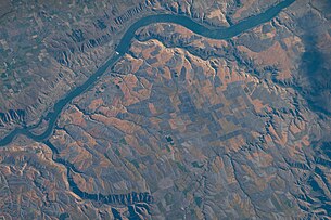 The dam and vicinity, taken from the International Space Station on July 4, 2022
 Cropped view of the dam on July 4, 2022
energy.wikisort.org - Power_plant
The John Day Dam is a concrete gravity run-of-the-river dam spanning the Columbia River in the northwestern United States.[3] The dam features a navigation lock plus fish ladders on both sides. The John Day Lock has the highest lift (at 110 feet or 34 meters) of any U.S. lock.[4] The reservoir impounded by the dam is Lake Umatilla,[5] and it runs 76.4 miles (123.0 km) up the river channel to the foot of the McNary Dam. John Day Dam is part of the Columbia River Basin system of dams.
| John Day Dam | |
|---|---|
 John Day Dam | |
| Location | Sherman County, Oregon / Klickitat County, Washington United States |
| Coordinates | 45°42′59″N 120°41′40″W |
| Construction began | 1958[1] |
| Opening date | 1971 |
| Construction cost | US$511 million |
| Dam and spillways | |
| Type of dam | Concrete gravity, run-of-the-river |
| Impounds | Columbia River |
| Height | 56 m (184 ft) |
| Length | 2,327 m (7,635 ft) |
| Spillway type | Service, gate-controlled |
| Reservoir | |
| Creates | Lake Umatilla |
| Total capacity | 2,530,000 acre⋅ft (3.12×10⁹ m3) |
| Power Station | |
| Operator(s) | U.S. Army Corps of Engineers |
| Type | Run-of-the-river |
| Turbines | 16 × 135 MW |
| Installed capacity | 2,160 MW |
| Annual generation | 8,418 GWh (2009)[2] |
Location
John Day Dam is located 28 miles (45 km) east of the city of The Dalles, Oregon, and just below the mouth of the John Day River. The closest town on the Washington side is Goldendale, 20 miles (32 km) north. The closest town on the Oregon side is Rufus, Oregon. Its crest elevation is approximately 570 feet (170 m) above sea level. It joins Sherman County, Oregon with Klickitat County, Washington, 216 miles (348 km) upriver from the mouth of the Columbia near Astoria, Oregon.
History
Construction of the dam began in 1958 and was completed in 1971,[1] making it the newest dam on the lower Columbia, at a total cost of US$511 million. The pool was filled in 1968 and a dedication ceremony was held on September 28, 1968.[6] John Day Dam was built and is operated by the U.S. Army Corps of Engineers. The condemnation of land upstream of the dam led to the Supreme Court case United States v. Rands,[7] a well-known case regarding the constitutional doctrine of navigable servitude. The dam's power generation capacity is 2,480,000 kW (overload capacity). The dam underwent a major repair to the upper lock gate in 2010, as documented in an episode of the National Geographic Channel program World's Toughest Fixes.[8]
Specifications
This section does not cite any sources. (April 2020) |
- Altitude: 266 feet (81 m) above sea level
- Height: 183 feet (56 m)
- Length: 7,365 feet (2,327 m)
- Navigation lock:
- Single-lift
- 86 feet (26 m) wide
- 675 feet (206 m) long
- Powerhouse
- Sixteen 135,000 kW units
- Total capacity: 2,160 MW
- Overload capacity: 2,485 MW
- Spillway
- Gates: 20
- Length: 1,228 feet (374 m)
Images


See also
- Hydroelectric dams on the Columbia River
- List of power stations in the United States
- List of hydroelectric power stations
- List of dams in the Columbia River watershed
- List of largest hydroelectric power stations in the United States
Sources
- "John Day Dam (Oregon - 164 ft. elev.)". Geographic Names Information System. United States Geological Survey. Retrieved 2006-05-10.
- "John Day Dam (Washington - 269 ft. elev.)". Geographic Names Information System. United States Geological Survey. Retrieved 2006-05-10.
References
- https://usace.contentdm.oclc.org/digital/api/collection/p16021coll11/id/426/download [bare URL PDF]
- "Carbon Monitoring for Action".
- "The Columbia River System Inside Story" (PDF). BPA.gov. pp. 14–15. Retrieved 17 July 2010.
- "A Sightseer's Guide to Engineering - Details for John Day Lock and Dam". Archived from the original on 2008-04-15.
- U.S. Geological Survey Geographic Names Information System: Lake Umatilla
- "John Day 50th Anniversary". Northwestern Division Website.
- "FindLaw's United States Supreme Court case and opinions". Findlaw.
- "World's Toughest Fixes on NGC". Archived from the original on 2011-07-27.
External links
Wikimedia Commons has media related to John Day Dam.
Crossings of the Columbia River | ||||
|---|---|---|---|---|
| ||||
На других языках
[de] John-Day-Talsperre
Die John-Day-Talsperre (englisch: John Day Dam) im Nordwesten der USA staut den Columbia River zum Lake Umatilla auf. Die Talsperre wurde von 1958 bis 1971 vom U.S. Army Corps of Engineers gebaut. Sie ist eine von mehreren Talsperren im Columbia-Becken.- [en] John Day Dam
[fr] Barrage John-Day
Le barrage John-Day (en anglais : John Day Dam) est un barrage hydroélectrique sur le fleuve Columbia, entre l'Oregon et l'État de Washington, aux États-Unis.Текст в блоке "Читать" взят с сайта "Википедия" и доступен по лицензии Creative Commons Attribution-ShareAlike; в отдельных случаях могут действовать дополнительные условия.
Другой контент может иметь иную лицензию. Перед использованием материалов сайта WikiSort.org внимательно изучите правила лицензирования конкретных элементов наполнения сайта.
Другой контент может иметь иную лицензию. Перед использованием материалов сайта WikiSort.org внимательно изучите правила лицензирования конкретных элементов наполнения сайта.
2019-2026
WikiSort.org - проект по пересортировке и дополнению контента Википедии
WikiSort.org - проект по пересортировке и дополнению контента Википедии