energy.wikisort.org - Power_plant
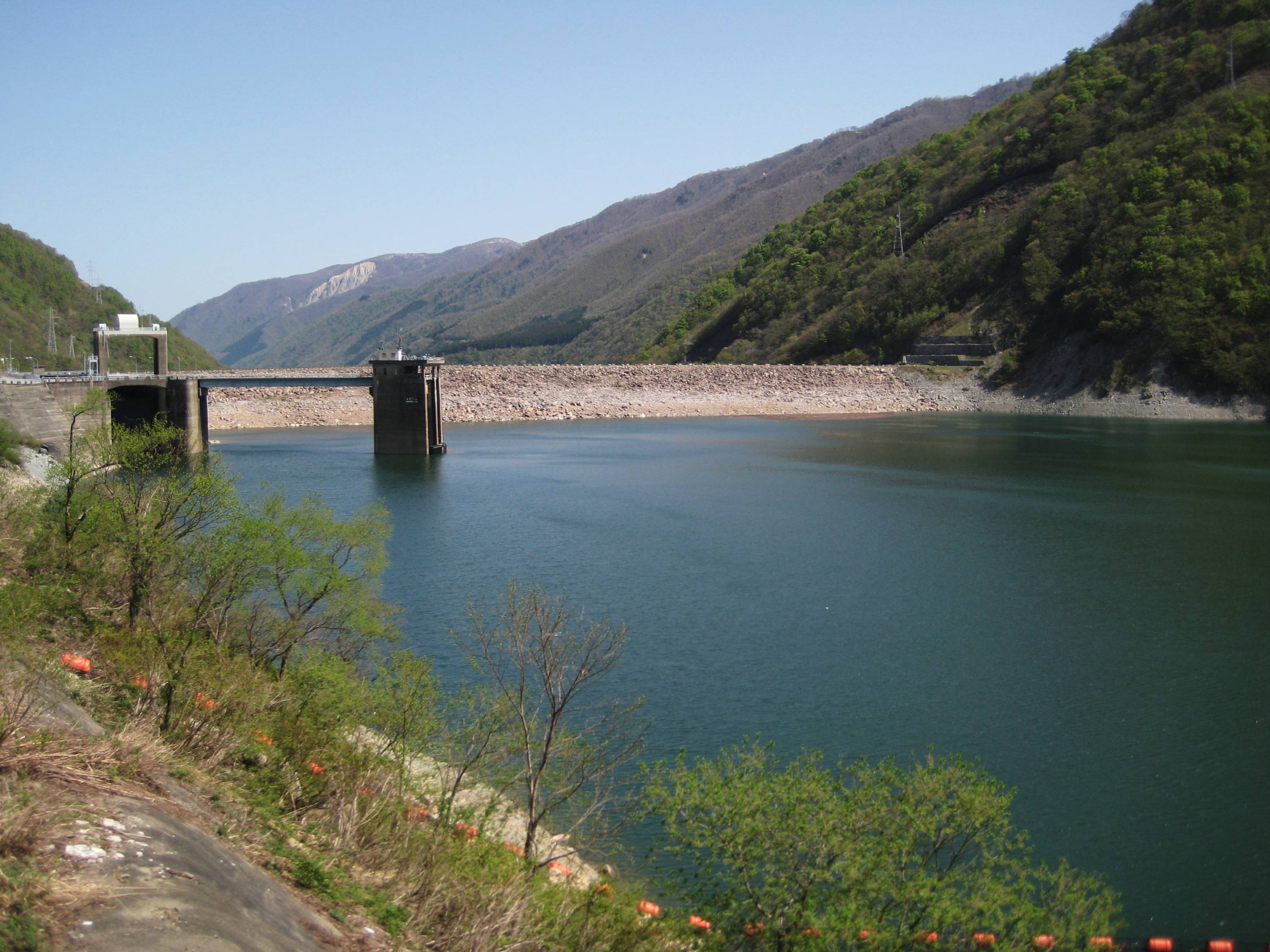
Miboro Dam (御母衣ダム, Miboro damu) is a dam on the Shō River in Shirakawa, in Gifu Prefecture Japan. It supports a 256 MW hydroelectric power station. Of the nine dams on the Shō River, it is the furthest upstream.[1][2]
This article may be expanded with text translated from the corresponding article in Japanese. (December 2008) Click [show] for important translation instructions.
|
| Miboro Dam | |
|---|---|
 | |
| Location | Shirakawa, Gifu Prefecture, Japan. |
| Purpose | Power |
| Status | Operational |
| Construction began | 1957 |
| Opening date | 1961 |
| Dam and spillways | |
| Type of dam | Embankment, rock-fill |
| Impounds | Shō River |
| Height | 131 m (430 ft) |
| Length | 405 m (1,329 ft) |
| Elevation at crest | 766 m (2,513 ft) |
| Width (crest) | 12 m (39 ft) |
| Width (base) | 560 m (1,840 ft) |
| Dam volume | 7,950,000 m3 (10,400,000 cu yd) |
| Spillways | 3 |
| Spillway type | 1 x roller gate, 1 x drum gate, lower discharge tunnel |
| Reservoir | |
| Total capacity | 370,000,000 m3 (300,000 acre⋅ft) |
| Active capacity | 330,000,000 m3 (270,000 acre⋅ft) |
| Catchment area | 442.8 km2 (171.0 sq mi) |
| Surface area | 8.8 km2 (3.4 sq mi) |
| Normal elevation | 760 m (2,490 ft) |
| Power Station | |
| Operator(s) | Kansai Electric Power Co., Inc. |
| Commission date | January/May 1961 |
| Hydraulic head | 192.1 m (630 ft) |
| Turbines | 2 x 128 MW Francis-type |
| Installed capacity | 256 MW |
The dam flooded several villages and shrines, submerging them completely, two cherry trees were taken from one of the submerged shrines and placed in Shirakawa-go where it is said that each petal represents a memory from someone who lived in the villages before they were flooded.[3]
Over 200+ houses were to be submerged, including Minka houses, and about 1,200 people were forced to relocate, so the residents of the planned submerged area violently opposed the dam construction plan. In 1961, all structures were submerged and the dam was completed.
References
- "Hydropower & Dams in South and East Asia" (PDF). Hydropower and Dams. p. 9. Archived from the original (PDF) on 2 September 2017. Retrieved 3 October 2010.
- "Kansai Electric Power Miboro power plant" (in Japanese). Suiryoku. Retrieved 28 July 2013.
- "Miboro Dam Japan Tourist Information". Retrieved 24 August 2014.
This article about a dam or floodgate in Japan is a stub. You can help Wikipedia by expanding it. |
This article about a Japanese power station is a stub. You can help Wikipedia by expanding it. |
Другой контент может иметь иную лицензию. Перед использованием материалов сайта WikiSort.org внимательно изучите правила лицензирования конкретных элементов наполнения сайта.
WikiSort.org - проект по пересортировке и дополнению контента Википедии