energy.wikisort.org - Power_plant
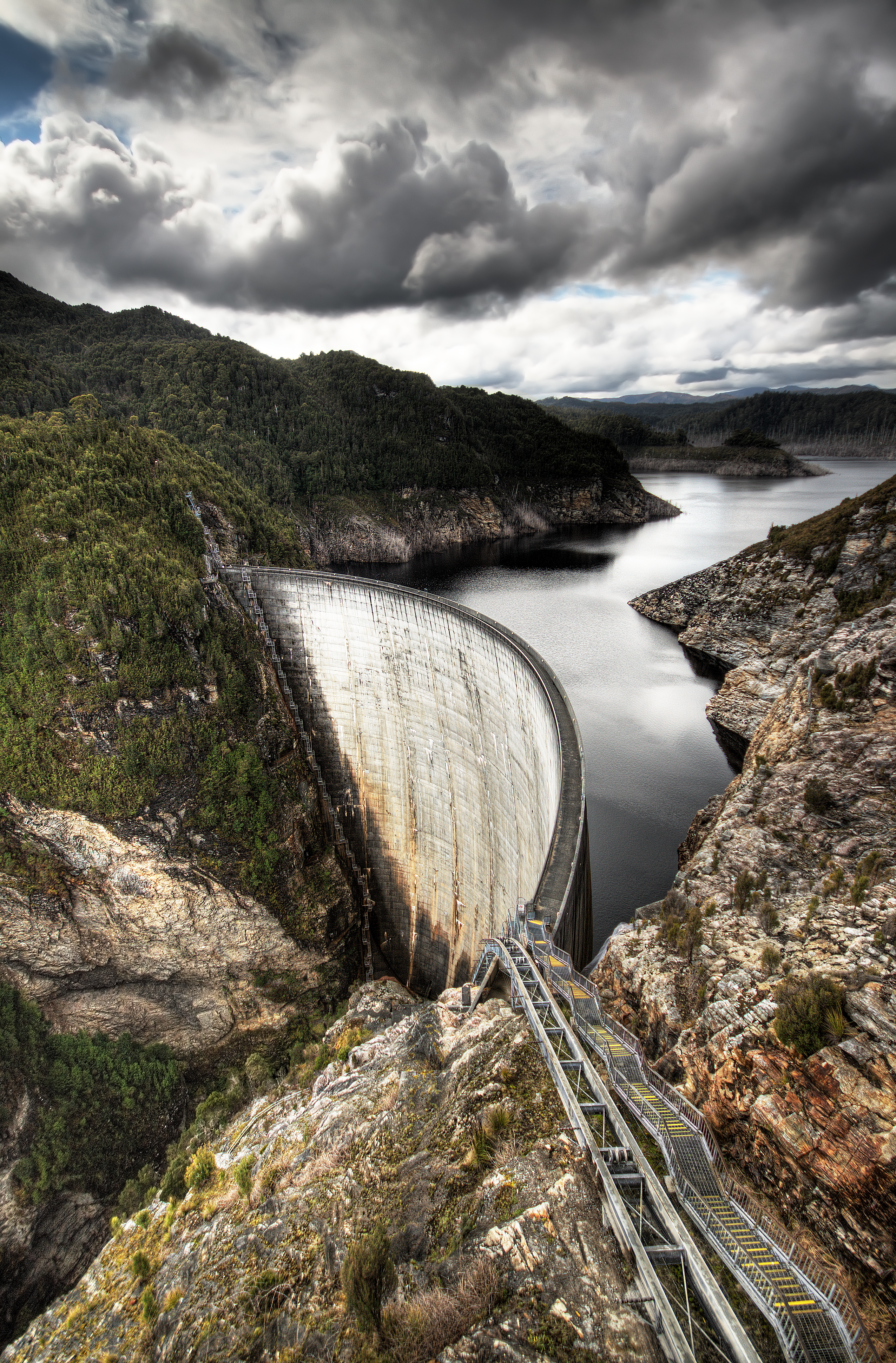
The Linganamakki Dam (Kannada : ಲಿಂಗನಮಕ್ಕಿ ಜಲಾಶಯ) was constructed by the Karnataka State Government in 1964. Located in the Kargal village of Sagara taluk, the dam has a length of 2.74 kilometres (1.70 mi) stretching across the Sharavathi river. It is located about 9 km from Jog Falls.[1] It has a storage capacity of 4.29 cubic kms or 151.52 tmc ft of water.
This article relies largely or entirely on a single source. (December 2018) |
| Linganamakki Dam | |
|---|---|
 | |
| Official name | Linganamakki Reservoir |
| Location | Linganamakki, Sagara Taluk, Karnataka |
| Coordinates | 14.175587°N 74.84627°E |
| Construction began | 1964 |
| Dam and spillways | |
| Impounds | Sharavathi River |
| Height | 193 ft |
| Length | 2.4 km |
| Reservoir | |
| Creates | Linganamakki Reservoir |
| Total capacity | 151.75 Tmcft |
| Catchment area | 1991.71 km² |

References
- Jain, Sharad K.; Agarwal, Pushpendra K.; Singh, Vijay P. (2007). Hydrology and Water Resources of India (Volume 57 of Water Science and Technology Library ed.). Springer Science & Business Media. p. 760. ISBN 9781402051807.
Dams and reservoirs | ||
|---|---|---|
| Africa |
|  |
| Asia |
| |
| Australasia |
| |
| Europe |
| |
| North America |
| |
| South America |
| |
| ||
This article about a dam, floodgate or canal in India is a stub. You can help Wikipedia by expanding it. |
This article related to a location in Shimoga district, Karnataka, India is a stub. You can help Wikipedia by expanding it. |
This article about an Indian power station is a stub. You can help Wikipedia by expanding it. |
Текст в блоке "Читать" взят с сайта "Википедия" и доступен по лицензии Creative Commons Attribution-ShareAlike; в отдельных случаях могут действовать дополнительные условия.
Другой контент может иметь иную лицензию. Перед использованием материалов сайта WikiSort.org внимательно изучите правила лицензирования конкретных элементов наполнения сайта.
Другой контент может иметь иную лицензию. Перед использованием материалов сайта WikiSort.org внимательно изучите правила лицензирования конкретных элементов наполнения сайта.
2019-2026
WikiSort.org - проект по пересортировке и дополнению контента Википедии
WikiSort.org - проект по пересортировке и дополнению контента Википедии