energy.wikisort.org - Power_plant
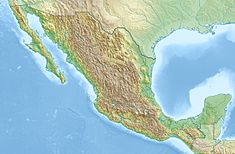
The Infiernillo Dam ("Little hell"), also known as Adolfo López Mateos Dam, is an embankment dam on the Balsas River near La Unión, Guerrero, Mexico. It is on the border between the states of Guerrero and Michoacán.[1] The dam supports a hydroelectric power station containing six turbine-generators for a total installed capacity of 1,120 MW. The dam is 149 m (489 ft) high, 344 m (1,129 ft) long and is owned by Comisión Federal de Electricidad. Its first generator was operational on January 25, 1965.[2][3]
| Infiernillo Dam | |
|---|---|
 | |
| Official name | Presa Adolfo López Mateos |
| Country | Mexico |
| Location | La Unión, Guerrero |
| Coordinates | 18°16′23″N 101°53′34″W |
| Status | In use |
| Opening date | 1965 |
| Owner(s) | Comisión Federal de Electricidad |
| Dam and spillways | |
| Height | 149 m (489 ft) |
| Length | 344 m (1,129 ft) |
| Width (base) | 570 m (1,870 ft) |
| Dam volume | 5,500,000 m3 (194,230,667 cu ft) |
| Reservoir | |
| Creates | Infiernillo Reservoir |
| Total capacity | 12,000,000,000 m3 (9,728,558 acre⋅ft) |
| Power Station | |
| Commission date | 1965 |
| Installed capacity | 1,120 MW |
Placement of the dam embankment began in August 1962, and on December 7, 1963, the dam was topped off. The diversion tunnels were closed and the reservoir began to fill on June 15, 1964.[4]
References
- "Google Maps". Google Maps. Retrieved 2022-01-31.
- "Hydroelectric" (in Spanish). CFE. Archived from the original on 26 January 2011. Retrieved 28 January 2011.
- "Monografía: Descripción de la represa hidroeléctrica "EL INFIERNILLO" (PDF) (in Spanish). CONSTRUCCIONES HIDRÁULICA. 2001. Archived from the original (PDF) on 6 July 2011. Retrieved 28 January 2011.
- Marr, sponsored by The Geo-Institute of the American Society of Civil Engineers ; edited by W. Allen (2002). A history of progress : selected U.S. papers in geotechnical engineering. Reston, Virginia: American Society of Civil Engineers. p. 1524. ISBN 0-7844-0656-1.
{{cite book}}:|first=has generic name (help)
На других языках
[de] El Infiernillo
El Infiernillo ist eine große Talsperre in Mexiko. Der Name Infiernillo bedeutet übersetzt „Kleine Hölle“. Außerdem trägt sie den Namen "Presa Adolfo Lopez Mateos" nach dem ehemaligen Präsidenten Mexikos Adolfo López Mateos. Sie liegt ca. 70 Kilometer von La Tzaráracua entfernt in der Gemeinde Arteaga in den Bundesstaaten Michoacán und Guerrero und in der Sierra Madre del Sur.- [en] Infiernillo Dam
Текст в блоке "Читать" взят с сайта "Википедия" и доступен по лицензии Creative Commons Attribution-ShareAlike; в отдельных случаях могут действовать дополнительные условия.
Другой контент может иметь иную лицензию. Перед использованием материалов сайта WikiSort.org внимательно изучите правила лицензирования конкретных элементов наполнения сайта.
Другой контент может иметь иную лицензию. Перед использованием материалов сайта WikiSort.org внимательно изучите правила лицензирования конкретных элементов наполнения сайта.
2019-2025
WikiSort.org - проект по пересортировке и дополнению контента Википедии
WikiSort.org - проект по пересортировке и дополнению контента Википедии
